We drove through the park to our campground in Torrey, UT, population 181. We stayed at "Thousand Lakes RV Park." I asked the lady where the name "Thousand Lakes" came from in the middle of the desert. She said it was named after "Thousand Lakes Mountain". Which she said was right behind the campground. BUT it didn't have any lakes on it. It did, however have hundreds of boulders. A cartographer got the names mixed up, so the mountain with all the lakes is named "Boulder Mountain." She also confirmed that most of the "lakes" were dry most of the year.
We got unhooked and set up in time to go back to the park for sunset.
It was raining very hard, someplace.


We have depended on friendly strangers for pictures of the two of us . After Yellowstone and the incredibly rude Chinese tourists blocking all the walk ways we decided we would NEVER buy a selfie stick.


The end of another incredible day. That was not planned.
The next morning we were back in the park. Not for sunrise, but early enough for the morning light.


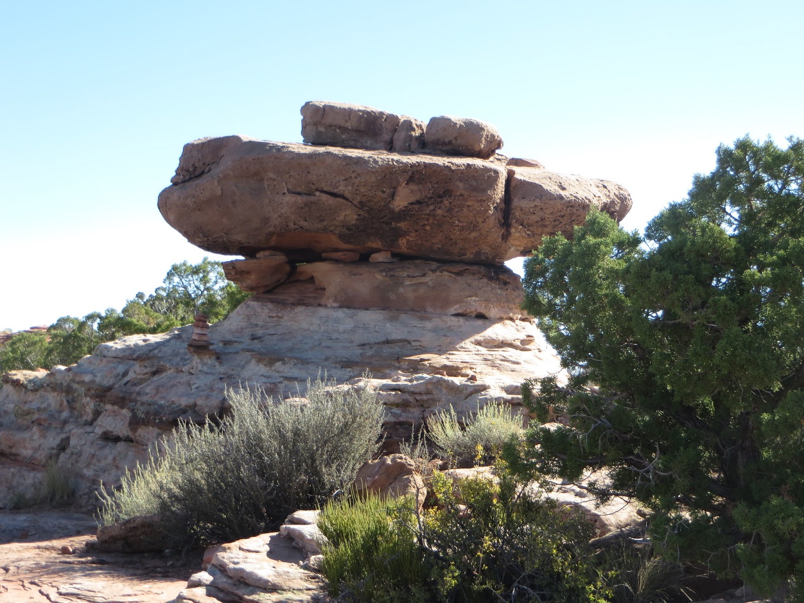
FINALLY, a geode worth splitting open for the treasure.

We walked the 4.8 mile round trip Grand Wash Trail.

Correction - when we walk in a really steep canyon, we can say we were in the Park by sunrise. IF you can wait until almost 10 AM.

The Narrows. at Capitol Reef.
NOT at Zion. Story to follow.


"YOU LOOKIN' AT ME?"

Another sunrise. This time around 11:30AM.

The Mormons settled this section in the late 1800's. It really is an oasis at the bottom of a canyon. And so incredibly hard to get to that they could practice polygamy without persecution. They were so successful growing fruit and vegetables that they named their settlement "Fruita." The Gifford House is one of the only remaining houses. It was built in 1908.
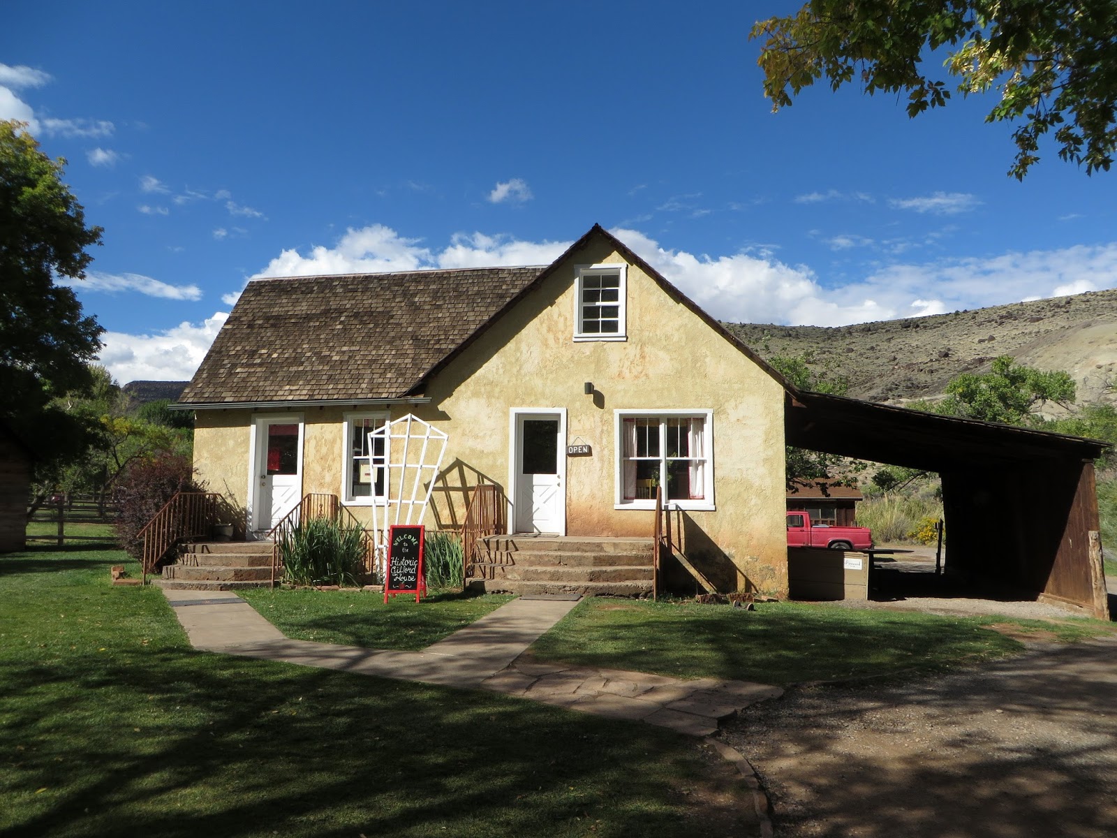
It is a working farm with orchards of apples, peaches, pears, cherries and garden plots of lots more fruits and vegetables. They are famous for their pies. We had been told repeatedly that we HAD to get some. After our almost 5 mile hike we felt we deserved it, so.......

We got a loaf of fresh baked bread, too. Carol got apple pie, mine was strawberry-rhubarb. We planned to eat half and get boxes to take the other half back to the Airstream.
A little while later.

This valley was inhabited LONG before the Mormons. These petroglyphs are thought to be from 600 to 1300AD. The meanings are unknown. But there are families, animals and strange human like figures with strange heads or headdresses.


It seems they were active polygamists. This is their original school building, built in 1896. Although there were only 8 families, the first class had 22 students. Three of whom were siblings of the teacher. Click here for more information and pictures.

The students made some petroglyphs of their own.

Just some more spectacular scenery as we leave the park.


We stayed in Torrey for the Saturday 6PM Mass. The Mission Church has a Priest that serves 5 Missions and 2 prisons so Saturday evening was the only Mass. He drives over 3000 miles a month. As the picture shows, the Church has 6 pews. The locals totaled about 10 but tourists filled the place and they put folding chairs out for the overflow.


The homily was wonderful. As we were leaving, we spoke to the people who were sitting next to us. They have an Airstream. Their third since retiring 20+ years ago. We talked in the parking lot for half an hour and headed back to our home on wheels.
We'll leave with the view from our RV park. It could have been the view from our Airstream but I felt lazy and opted for a "pull thru" space instead of backing into one up against the creek.


To beat that old dead horse. One of the most beautiful places we've seen. NOT in our plans. Just went because friendly people along the way told us to. God winks every day.
Onward and Upward to Bryce Canyon National Park.