In just a few years there will be no one alive who knows what "Kodachrome" was. And that will be a terrible shame.
Because, "Momma don't take my Sim Card away." just doesn't have the same feeling.
For my OLD friends who "got" that reference -- and for my young friends who need an education in good music, click here.
It was in 1948 that the National Geographic Society explored this area and named it for its spectacular colors. The State got permission from Kodak to keep the name when it became a state park.
Another major in between. Based on TripAdvisor and Campendium.com I REALLY wanted to camp there as the base for Bryce. They didn't have any spots available. BUT turns out it's 20+ miles to Bryce and the first 10 or so are 35 mph on the park entrance road. My second choice was Bryce Canyon Pines RV park which was 3 miles from the Park. Thank you Lord.
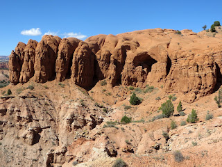
We did decide to drive to Kodachrome during our stay in the area. The big deal is the collection of 67 "pipes". These are monolithic stone spires. Although they are found in a few other places in the world, Kodachrome has many more of them than most locations. The scientists don't have a clue as to how they were formed. Wait. That's not completely accurate. Scientists say they do know. But there are three or four different groups of scientists who say they know. And they all have different theories.
The white layer of sandstone is the top layer in this area. It's only about 95 million y ears old.
And some of the biggest spires are all white.
Others are red.
Some are both.
Carol thought this looked like a white wolf climbing thier red sandstone. Do you see him?
How about now? Click on it to see it enlarged.
At the end of the road was a Nature Trail. "Hard Surface 0.5 mile round trip. ADA accessible. Sounded good to me. Lots of interesting stuff about the plants and animals. Not so much for picture taking.
Next was "Angel's Palace Trail." Listed as "rising 150 ft. 1.5 mile. Easy/Moderate." That didn't sound too bad either. It did offer spectacular views.
We're maybe half way up here. There's our Big Red Truck.
Unfortunately to get the BEST pictures required walking this "neck" to an overlook.
Which Carol did.
Then I guess we got to the "Moderate" part. What you can't see from here is that as the trail narrows, it slants to the canyon side and it's loose stone.
But we continued.
A Pipe that apparently has lost its white cap.
Interesting colors.
Some of the views they promised us.
My idea of a cairn.
So --- an "Easy/Moderate" done and it's still early in the day.
Let's try "Shakespeare Arch- Sentinel Trail". "Easy to Shakespeare Arch. Moderate to Strenuous from there." "Gives the user magnificent views of Grand Staircase-Escalante National Monument."
OK, we'll do the "Easy" and see what the rest looks like.
I guess we're going around this somehow.
Nope. We're going UP it.
The Shakespeare Arch.
Another Pipe.
Miniature Arch ?
And were rewarded with more views of the Escalante.
Enlarge this picture and look for the trail we had just been on a few minutes before.
HINT. It's on the left side of the picture.
And it's as narrow as it looks.
We were very glad to call it a day for hiking. The one last thing we wanted to see was "Chimney Rock". Which we could drive to. "Four wheel drive, high clearance vehicles recommended." HEY. It didn't say "required."
Here we are after several miles of bone jarring washboard dirt road.
I found a "fixer upper" but Carol doesn't want to settle here.
One last view as we leave the Park.
OK.. Two.
Tomorrow we head for Zion.


No comments:
Post a Comment